| Author |
 Topic Search Topic Search  Topic Options Topic Options
|
BuckSkin 
Orange Level

Joined: 12 Sep 2019
Location: Poor Farm
Points: 1192
|
 Post Options Post Options
") Thanks(1) Thanks(1)
 Quote Quote  Reply Reply
 Topic: Ellinwood - Kansas Topic: Ellinwood - Kansas
Posted: 06 Feb 2025 at 11:25am |
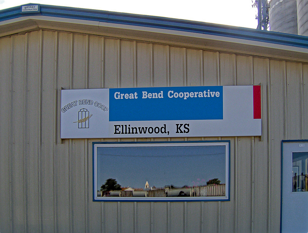
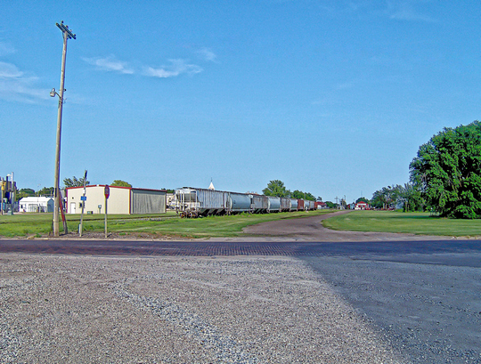
Great Bend Cooporative Elevator Ellinwood - Barton County - Kansas Tuesday_15-July-2014
Scale House at Ellinwood Elevator
Notice how the rail-cars on the spur track are reflected in the window.
Check out Satellite View at these coordinates: 38.353635° -98.585204° 549.2496 m 1,802'
|
 |
|
Sponsored Links
|
|
|
BuckSkin
Orange Level
Joined: 12 Sep 2019
Location: Poor Farm
Points: 1192
|
Post Options
Thanks(0)
Quote Reply
Posted: 06 Feb 2025 at 1:27pm |
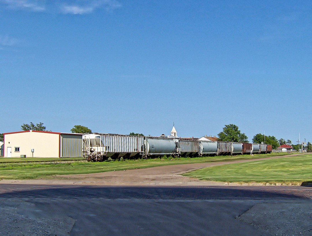
Tuesday_15-July-2014
Covered Hoppers on Ellinwood Elevator Spur Track
This is the "Northern Branch" of Santa Fe's main line between Chicago and Los Angeles.
Now owned by Kansas & Oklahoma RxR; this is the 72-mile Kansas & Oklahoma Great Bend Subdivision from Hutchinson to Larned via Great Bend.
|
|
BuckSkin
Orange Level
Joined: 12 Sep 2019
Location: Poor Farm
Points: 1192
|
Post Options
Thanks(0)
Quote Reply
Posted: 06 Feb 2025 at 2:24pm |
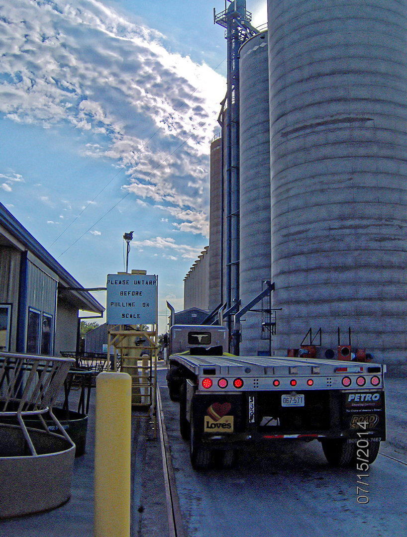
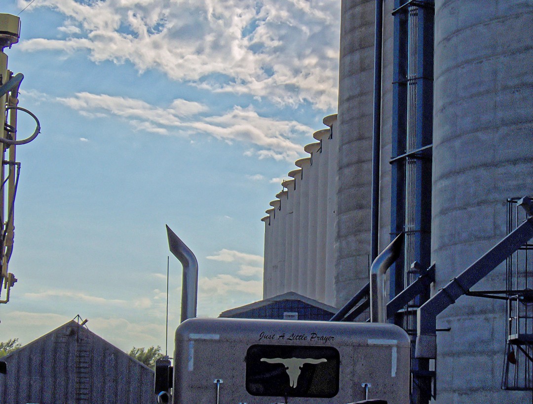
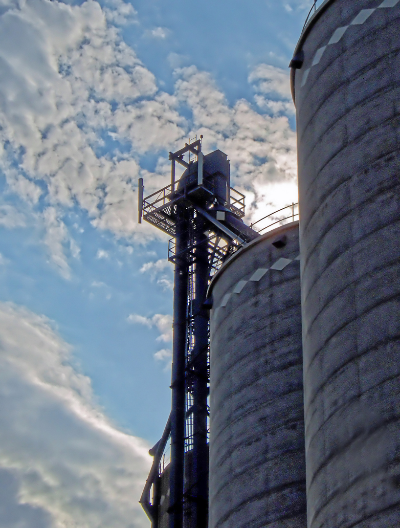
Scales at Great Bend Cooporative Elevator Ellinwood - Barton County - Kansas Tuesday_15-July-2014
The Silos at Great Bend Cooperative Elevator
There are four of these huge silos and twenty smaller silos that are plenty huge in their own right.
The big silos dwarf the twenty smaller ones; and, it appears that a single one of the larger silos could hold the contents of all twenty smaller ones.
The truck/trailer on the scales is the 379 Peterbilt that I am driving.
|
|
BuckSkin
Orange Level
Joined: 12 Sep 2019
Location: Poor Farm
Points: 1192
|
Post Options
Thanks(0)
Quote Reply
Posted: 06 Feb 2025 at 3:49pm |
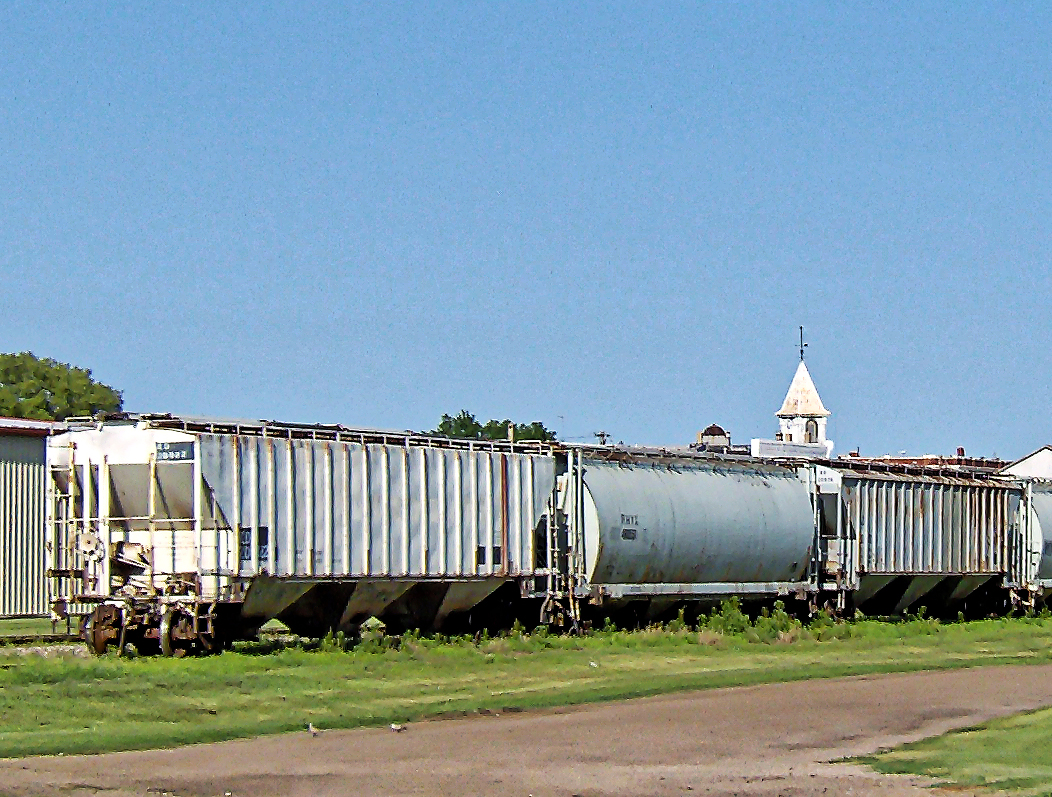
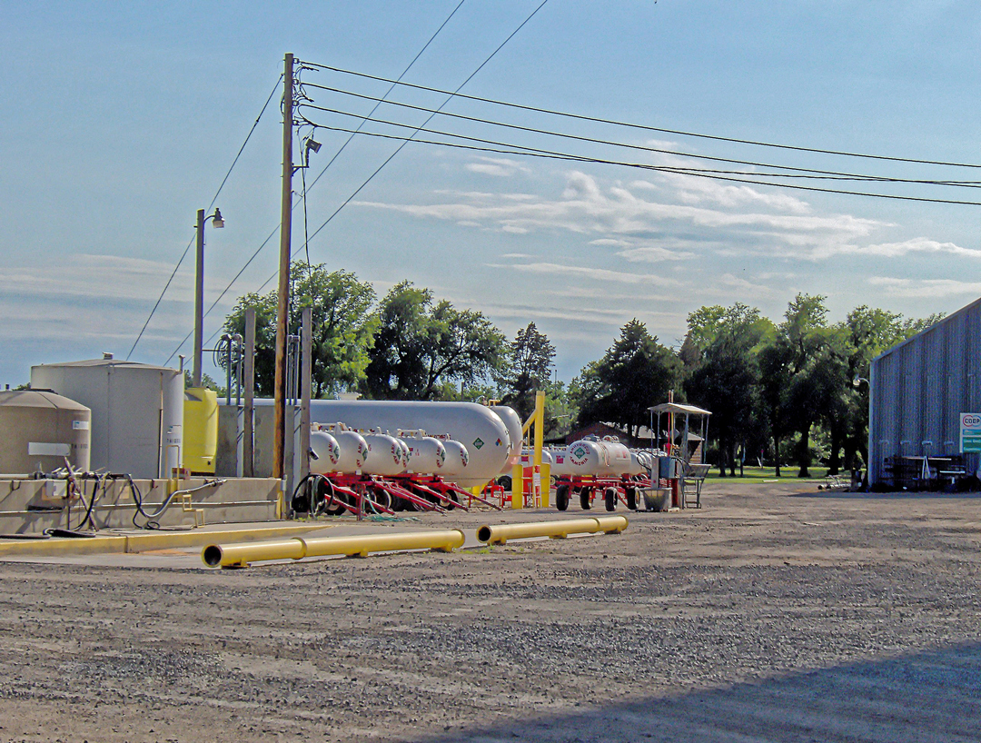
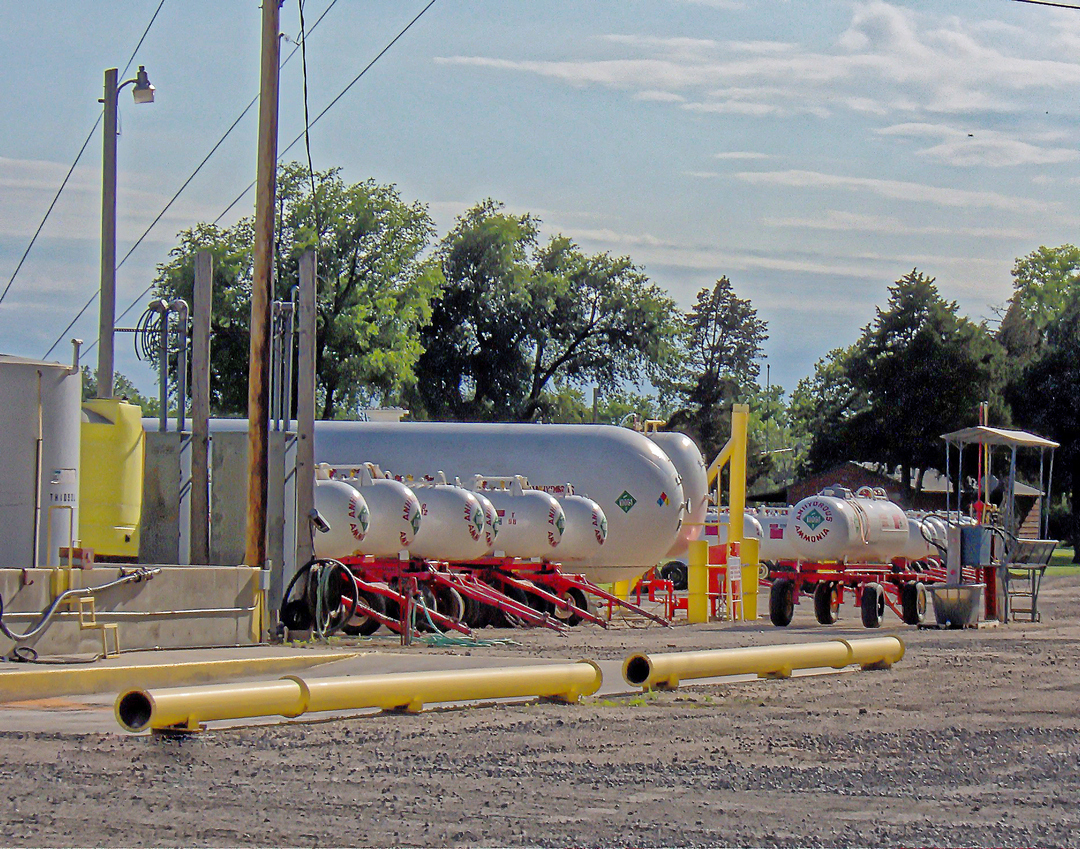
Tuesday_15-July-2014
Anhydrous Ammonia Tank Wagons
|
|
Ted J
Orange Level

Joined: 05 Jul 2010
Location: La Crosse, WI
Points: 18967
|
Post Options
Thanks(1)
Quote Reply
Posted: 06 Feb 2025 at 3:58pm |
|
Thanks for the info. Years ago we played a railfoad game at work. It was interesting to learn the different railroads from back then and where they are now and who owns em. Thanks for sharing!
|
|
"Allis-Express"
19?? WC / 1941 C / 1952 CA / 1956 WD45 / 1957 WD45 / 1958 D-17
|
|
BuckSkin
Orange Level
Joined: 12 Sep 2019
Location: Poor Farm
Points: 1192
|
Post Options
Thanks(0)
Quote Reply
Posted: 06 Feb 2025 at 4:10pm |
 Ted J wrote: Ted J wrote:
Thanks for the info. Years ago we played a railfoad game at work. It was interesting to learn the different railroads from back then and where they are now and who owns em. Thanks for sharing! |
I appreciate that you enjoy my efforts.
|
|
BuckSkin
Orange Level
Joined: 12 Sep 2019
Location: Poor Farm
Points: 1192
|
Post Options
Thanks(0)
Quote Reply
Posted: 06 Feb 2025 at 10:59pm |
Tuesday_15-July-2014
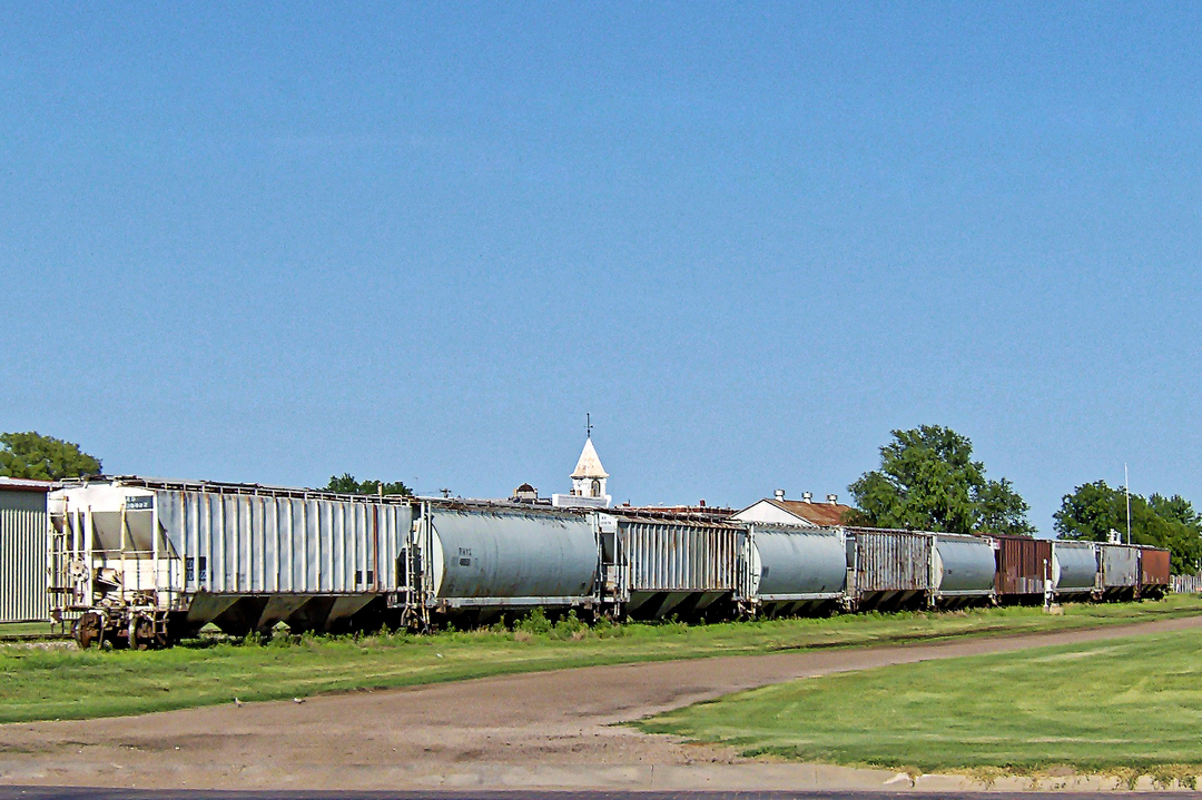
The Bell Tower visible above the rail-cars is atop the Ellinwood Emporium(1887) on the N-W corner of Santa Fe and Main.
The Red and White building, deep into the scene, beyond the grass, is Ellinwood Pump & Supply, an oilfield supply company. In street view, you can see pump-jacks and tanks behind the building.
Check out Satellite View at these coordinates: 38.353556° -98.583048° 546.8112 1,794'
|
|
dr p
Orange Level
Joined: 24 Feb 2019
Location: new york
Points: 1547
|
Post Options
Thanks(1)
Quote Reply
Posted: 07 Feb 2025 at 6:29am |
|
I appreciate you shared a picture with green grass and trees in bloom!
|
|
ihc pickups
Bronze Level Access

Joined: 04 Apr 2017
Location: NE KS.
Points: 138
|
Post Options
Thanks(1)
Quote Reply
Posted: 07 Feb 2025 at 6:57am |
Great great pictures. Thanks for sharing them.
|
|
Mike
|
|
BuckSkin
Orange Level
Joined: 12 Sep 2019
Location: Poor Farm
Points: 1192
|
Post Options
Thanks(0)
Quote Reply
Posted: 07 Feb 2025 at 1:12pm |
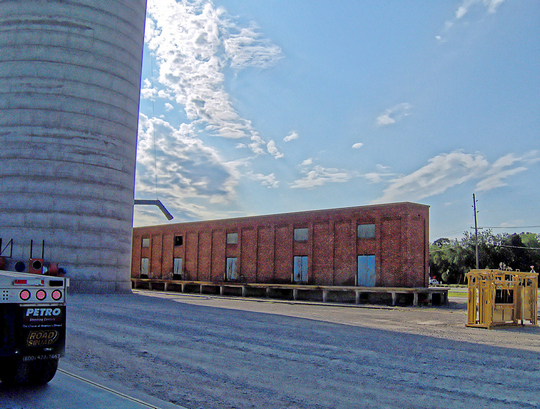
Tuesday_15-July-2014
A very good history of Ellinwood can be read HERE
Historic Brick Grain Bin Building
This historic building dates back to when loose grain was hauled in standard boxcars and loaded/unloaded with scoop-shovels.
As the level of grain rose within the boxcar, planks were added behind the doorway and then removed one plank at a time as the grain was unloaded.
The yellow apparatus is a Cattle Squeeze Chute, either for rent, loan, or sale to members of the coop.
Edited by BuckSkin - 07 Feb 2025 at 1:14pm
|
|
BuckSkin
Orange Level
Joined: 12 Sep 2019
Location: Poor Farm
Points: 1192
|
Post Options
Thanks(0)
Quote Reply
Posted: 07 Feb 2025 at 1:33pm |
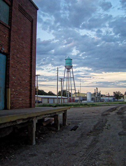
Tuesday_15-July-2014
Ellinwood Water Tower
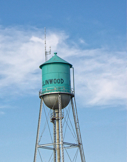
Between the camera and the water tower, nearest the camera is the Great Bend Cooperative RxR Spur, then the "Northern Branch" of Santa Fe's main line between Chicago and Los Angeles, then 640-mile long US Hwy 56 from Kansas City, Missouri, to Springer, New Mexico; photo Left is West; photo Right is East.
The white fuel tank and smoke-stacks right of the water tower are Ellinwood Light & Power, an electricity generating plant.
|
|
BuckSkin
Orange Level
Joined: 12 Sep 2019
Location: Poor Farm
Points: 1192
|
Post Options
Thanks(0)
Quote Reply
Posted: 07 Feb 2025 at 1:59pm |
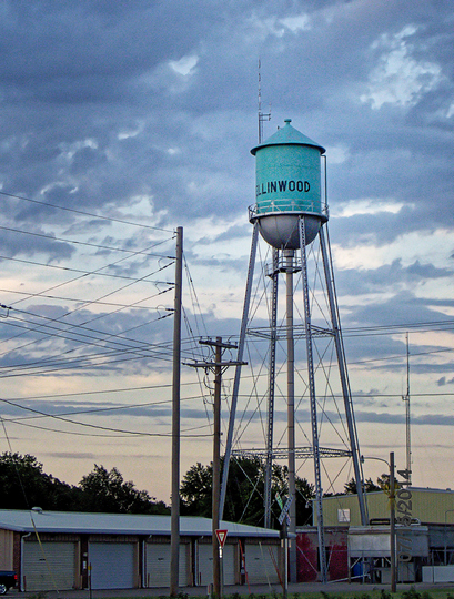
Tuesday_15-July-2014
Ellinwood Water Tower
Check out Satellite View at these coordinates: 38.354402° -98.583919° 548.0304 m 1,798'
|
|
BuckSkin
Orange Level
Joined: 12 Sep 2019
Location: Poor Farm
Points: 1192
|
Post Options
Thanks(0)
Quote Reply
Posted: 07 Feb 2025 at 4:36pm |
Tuesday_15-July-2014
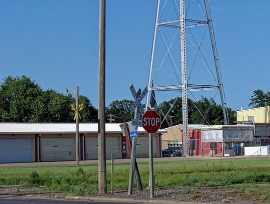
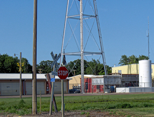
The legs are Ellinwood Water Tower
Although the RxR Crossing Sign says "3 Tracks", since at least as early as 2001, there have only been two.
The nearest track is the Ellinwood Elevator Spur Track; the farther track is the "Northern Branch" of Santa Fe's main line between Chicago and Los Angeles.
The smoke stacks and big white fuel tank at right in the photos is Ellinwood Light & Power, an electrical generating facility that looks to be still in operation.
Straight over the STOP sign, through the legs of the tower, you can see the Steeple of St. Joseph's Catholic Church, which is in the corner of West 3rd Street and North Main, quite a ways across town.
This Steeple is quite interesting as it also houses a clock that has faces on all four sides and most likely also serves as a Bell Tower.
About two-thirds the way up on the light pole at left is what I first thought was a bundle of Indian Arrows; Street View dated 2024 shows them to be a Shock of Wheat and every light pole in town seems to be decorated likewise.
Ellinwood has a most interesting history and is well worth a read HERE.
|
|
BuckSkin
Orange Level
Joined: 12 Sep 2019
Location: Poor Farm
Points: 1192
|
Post Options
Thanks(0)
Quote Reply
Posted: 08 Feb 2025 at 8:54pm |
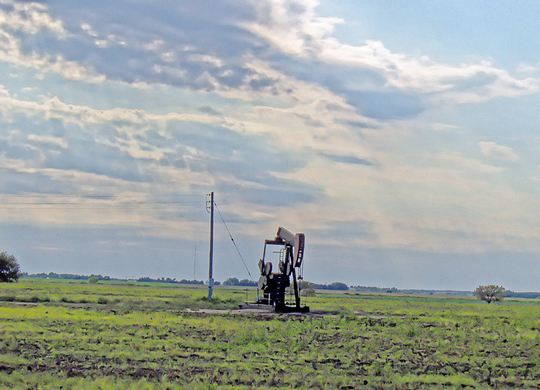
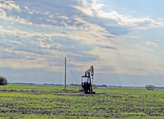
Photo Taken from the Driver-side Door-glass of a 379 Peterbilt Tuesday_15-July-2014
Located on the West side of NE90 Avenue, North of US Hwy 56.
Check out Satellite View at these coordinates: 38.379345° -98.612346° 551.3832 m 1,809'
|
|
BuckSkin
Orange Level
Joined: 12 Sep 2019
Location: Poor Farm
Points: 1192
|
Post Options
Thanks(0)
Quote Reply
Posted: 22 Feb 2025 at 9:52am |
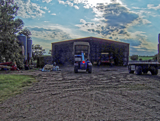
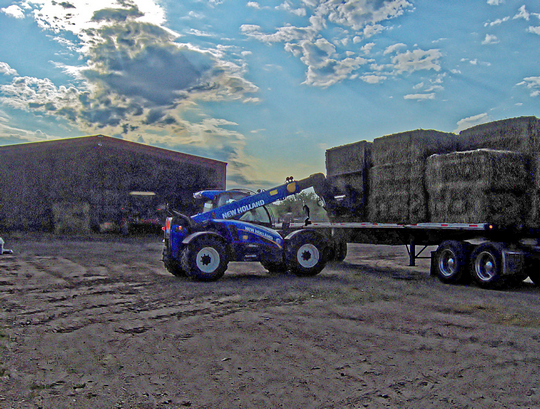
Miller's Hay Sales Ellinwood - Barton County - Kansas Tuesday_15-July-2014
2003_New Holland LM5060 Telehandler Telescoping Hay Loader
This is the farmer's version of a Sky Trac.
Located on the West side of NE80 Avenue, North of US Hwy 56.
Check out Satellite View at these coordinates: 38.415152° -98.629295° 556.26 m 1,825'
NOTE: Please excuse the poor quality of these photos; I was shooting straight into that bright evening sun.
|
|
BuckSkin
Orange Level
Joined: 12 Sep 2019
Location: Poor Farm
Points: 1192
|
Post Options
Thanks(0)
Quote Reply
Posted: 31 Mar 2025 at 1:45am |
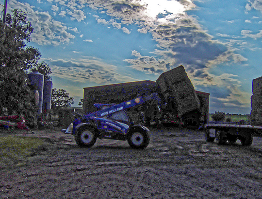
Miller's Hay Sales Ellinwood - Barton County - Kansas Tuesday_15-July-2014
New Holland Self-Propelled Mower Conditioner Windrower
This machine cuts the hay, crimps and conditions it (squishes out the moisture), and leaves it in a windrow to keep it off the ground and allow air to circulate through it better than as if it were spread on the ground.
|
|
BuckSkin
Orange Level
Joined: 12 Sep 2019
Location: Poor Farm
Points: 1192
|
Post Options
Thanks(0)
Quote Reply
Posted: 26 Apr 2025 at 12:34am |
Ellinwood - Barton County - Kansas Tuesday_15-July-2014
Head Gate Squeeze Chute and a Loading Chute
These were the tools of my trade for a great part of my working life.
I was shooting straight into the murderous evening sun; but, it was either take not-so-great photos or none at all.
Located on the West side of NE80 Avenue, North of US Hwy 56.
Check out Satellite View at these coordinates: 38.415152° -98.629295° 556.26 m 1,825'
 - --- - 
|
|